Katherine Road: from county lane to city street
About this record
Katherine Road is one of the oldest roads in the area, visible on maps going back to the 1700s. Here, we discover how it transformed from country lane into a busy collection of shops, businesses and houses.
If you walk along Katherine Road today, you’ll find a vibrant and busy street, home to shops, businesses, schools and houses all along its length. It links two of the main routes through Newham – Romford and Barking Roads – and crosses East Ham and Forest Gate postcodes (E6 and E7).
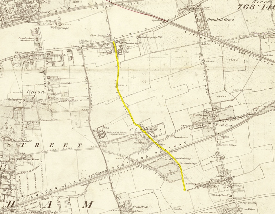
Katherine Road has always been an important thoroughfare for the local community, as we can see from maps dating back to 1777, when the road is clearly visible (see map below, Katherine Road marked in yellow). However, in those days it was little more than a country lane with farms, large private houses, gardens and cottages.
East Ham lanes were some fifteen feet wide, and were more often than not lined with grand old trees, whose branches nearly met overhead. Beautiful meadows lay on either side, dotted about with cattle, and sheep and lambs.

What’s in a name?
The road name ‘Katherine’ doesn’t appear until the late 19th century. Before this, the road was split between Red Post Lane in the north and Plashet Lane to the south. The roads met at the hamlet of Plashet, located at what is now the crossroads between Plashet Grove and Katherine Road.
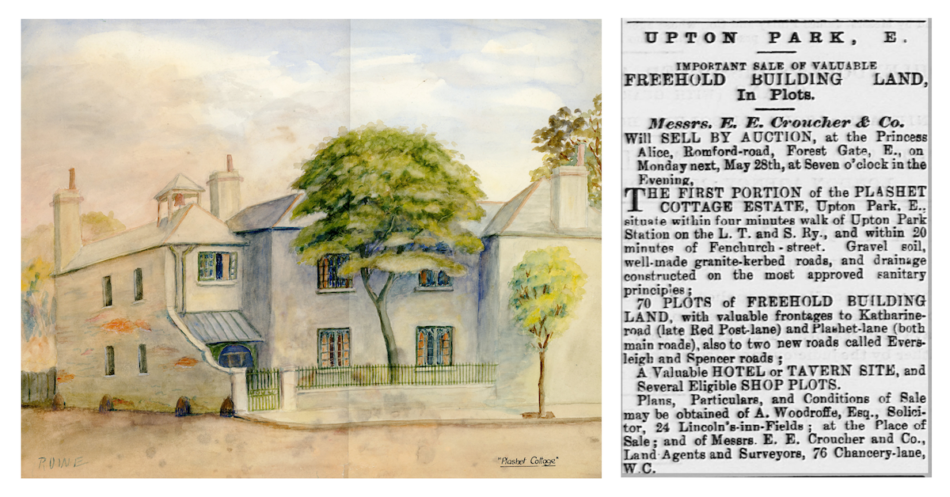
It was the site of the substantial Plashet House (shown above), which was the home of social and prison reformer Elizabeth Fry and her family until 1829. And it is for Elizabeth’s oldest daughter, Katharine, that Plashet Lane was renamed Katherine Road in 1888 (though not with quite the same spelling). The name Red Post Lane disappears too and has become Katherine Road by 1913 (see Ordnance Survey map, below).

From countryside to town
Neighbouring West Ham was already a more populated parish than East Ham in the early part of the 19th century. Then with the coming of the railway, the number of people moving to the area grew even more rapidly. With the construction of the docks and factories along the Thames, the need for housing increased and the former villages merged together.
Katherine Road was right in the path of the advancing housing (as can be seen in the OS maps above). However, it was also within easy reach of both Upton Park and East Ham stations, so was perfectly placed for local workers and those looking to commute into the City of London. Katharine Fry, a keen local historian, wrote a history of East and West Ham (published posthumously in 1888), in which she commented on how quickly the area was changing towards the end of her life. Indeed by the end of the 19th century, Plashet House and others like it were sold off and demolished, and the land used to create the streets seen today.
While a few years ago East Ham was still a village of market gardens for the production of cabbages and onions, it is now fast becoming a manufacturing and residential town. The wide area of arable lands…has been gradually converted into streets of crowded dwellings, almost entirely inhabited by artisans and the humble city clerks.
Supply and demand
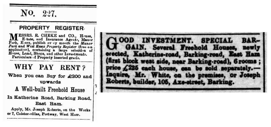
Builders wasted no time in buying up those plots of land and building homes, shops and public houses. Joseph Roberts, a builder from Barking, clearly got in early, placing a prominent advertisement on 25 February 1893 in the Barking, East Ham & Iford Advertiser. He asked readers, ‘Why pay rent? When you can buy for £200 and upwards a well-built freehold house…’ (above left). And by June 1893, Roberts is ready to sell, with ‘Several freehold houses, newly erected, Katherine-road (first block west side, near Barking-road), 6 rooms; price £225 each house…’ (above right).
Nearby, the Earl of Wakefield was purpose built as a public house and in the Essex Herald, 11 September 1894, it was reported that Frank Howe had made an application for a full licence for the pub. The application was refused because ‘the district is not yet fully developed’. However, as Frank Howe is duly listed as a ‘beerseller’ on Katherine Road in the Kelly’s Directory of Essex for the same year, the Earl of Wakefield was nonetheless up and running. Katherine Road was rapidly changing.

To read more about how Katherine Road developed, see Katherine Road: the history around us.
Additional record details
- Contributor: Ruth Bell
- Type: PhotographsWriting
- Date created: 22 April 2024
- Location: Katherine Road, London E6 / E7
Heritage newsletter
We would like to send you monthly emails spotlighting heritage content in Newham, as well as updates and opportunities to be involved in next year's festival. Be the first to hear about new projects, funding opportunities and ways to be involved.